
Interactive 2D/3D GIS Web Platform | Jubail & Yanbu, Saudi Arabia
Client: Royal Commission for Jubail and Yanbu (RCJY)
Year: 2024–2026 | Category: 3D GIS • Interactive Web Platform • Investor Experience • Admin Dashboard
Project Overview:
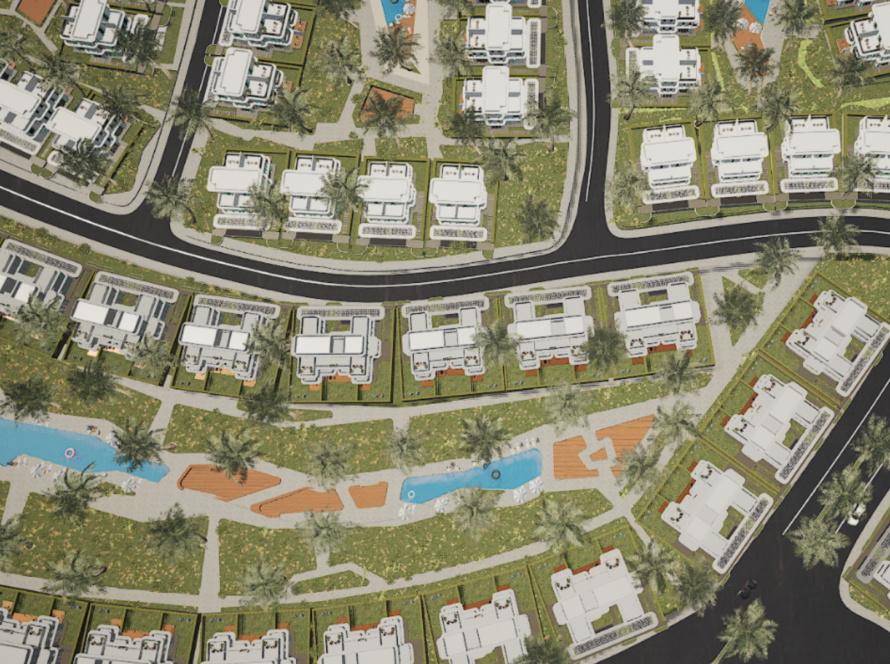
Metas developed RCJY Maps as an interactive web-based mapping platform to showcase investment opportunities across Jubail and Yanbu industrial cities. The platform combines 2D and 3D GIS visualization with immersive exploration and multilingual support, enabling investors and visitors to discover, filter, and understand city land lots, industrial clusters, and development potential. RCJY Maps aligns with Saudi Vision 2030 by enhancing investor engagement and supporting industrial growth through digital transformation.
Project Goals:
- Deliver an engaging interactive experience for investors and visitors exploring Jubail and Yanbu.
- Communicate city updates, land lot availability, and market potential clearly.
- Attract and captivate conference attendees and long-term investors.
- Support RCJY’s investment enablement strategy using interactive GIS visualization.
The Experience:
- Persona-Based Interactive Journey: The platform identifies user types (industrial investor, commercial investor, visitor) and adapts the experience to show relevant opportunities and insights.
- 2D + 3D GIS Exploration: Users navigate locations, districts, and industrial clusters with clear visual context. Optional 3D maps and building models enhance spatial understanding.
- Multilingual Support & Search: English, Chinese, and other languages are supported to engage international investors efficiently.
- Opportunity Discovery & Filtering: Investors can browse, filter, and link opportunities to relevant investment platforms, enabling practical and actionable insights.
Scope & Deliverables:
- Web-based interactive mapping platform for Jubail & Yanbu
- UI/UX design for visitors and dedicated admin dashboard
- Database hierarchy for continuous updates and opportunity management
- Deployment on RCJY servers or cloud environment
- Documentation and guidance for interactive features
Key Features:
- Persona-based onboarding for targeted content
- Multilingual interface and map search
- Contact capture for interested investors
- Industrial cluster guidance maps
- City landing pages with statistics and insights
- Admin dashboard for data updates and analytics
- Optional 3D building visualization
- Filtering and linking opportunities to investment platforms
Technology & Production:
- Platform: Web-based interactive mapping experience
- Experience Type: 2D + 3D GIS immersive exploration
- Front-End: JavaScript for interactive implementation
- Admin System: Database + Admin Dashboard for ongoing updates and analytics
- Deployment: Server/cloud deployment on RCJY environment
Why This Works for Investor Engagement:
- Transforms complex city data into an easy-to-understand, map-first narrative.
- Supports international investors with multilingual navigation and search.
- Keeps information current through admin tools, reducing reliance on static brochures.
- Creates a memorable conference and digital engagement experience, improving recall and follow-up.
Summary:
RCJY Maps demonstrates Metas’ ability to deliver interactive, web-based GIS platforms that transform industrial city data into engaging, actionable, and multilingual experiences. The platform supports investor decision-making, enhances city visibility, and contributes to Saudi Vision 2030 goals around industrial development and global investment attraction.